As 3 dangers converge, California's coast faces rare winter of big waves, erosion, flooding
Published in News & Features
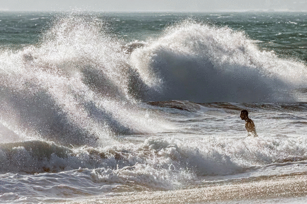
LOS ANGELES — A rare convergence of a powerful El Niño, super king tides and sea level rise spurred by climate change could menace California with record coastal flooding this winter.
Already, officials are observing higher tides than typical. Swells are eroding beaches, damaging parking lots and bathrooms, and even resurfacing long-buried coastal infrastructure.
And that's before El Niño even kicks into high gear.
Jonathan Warrick, a research geologist with the U.S. Geological Survey, said that the climate pattern — commonly viewed as a rainmaker in Southern California — also turbocharges the sea.
"There's a phenomena during El Niños where the waters offshore California get warmer, and they actually rise up, up to a foot, sometimes more, higher than average," he said.
That may not seem like much, but it's more than enough to wreak havoc on lower-lying homes and coastal infrastructure. Over the past 125 years, the average sea level in San Francisco Bay, for example, has already risen by about 1 foot — an increase experts link to human-caused climate change.
"Folks who really think about coastal risks are very concerned that the single-highest sea levels on record are quite possible this winter in California," said Daniel Swain, a UC climate scientist. "And that is going to be a problem."
This pattern has happened before. During the "very strong" El Niños of 1982-83 and 1997-98, as well as the "strong" El Niño of 2023-24, San Francisco Bay logged record monthly average sea levels.
"The fact that our seas will be higher than average is a very concerning factor for coastal erosion and wave impact on cliffs and other structures near the coast, for coastal flooding," Warrick said.
That can be doubly true if El Niño lives up to its rainy reputation. Rain falling on land looks for a place to drain. "If the oceans are higher," Warrick said, "then it's harder for that water to get off the landscape."
El Niño, a climate pattern characterized by warmer ocean waters in the central and eastern tropical Pacific Ocean, is already causing sea levels to rise off the coast of Latin America. That's because ocean water expands as it heats.
In June, NASA released a visualization showing sea levels were more than half a foot higher than baseline off the Pacific coast of Peru, Ecuador, Colombia and Panama.
Now, "water levels are already half a foot to a foot above average" along much of the South American Pacific coast, Swain said. "Similarly, as we go up through Central America and up the west coast of Mexico and into the Gulf of California, water levels are similarly now approaching or even exceeding a foot above average in this region."
For months, parts of the California coast have been experiencing a marine heat wave unrelated to El Niño. But "it is possible that the most recent heating off Southern California within the week of August 15th may finally be the result of some more direct warming due to El Niño drivers," according to the National Oceanic and Atmospheric Administration's marine heat wave tracker.
On Wednesday and Thursday, tides were coming in about 6 inches higher than the official forecast in San Diego, the Port of Los Angeles, Santa Barbara and Mendocino County's Arena Cove; 5 inches higher in San Francisco and Santa Monica; and 4 inches higher in Monterey. In Humboldt County's North Spit, near Eureka, tides were 9 inches higher than forecast.
"What we're observing is actually tides that are ... 4 to 6 inches above predicted. And that's quite a bit," said Jeremy Smith, a coastal engineer with the California Coastal Commission.
But what will be exceptionally bad timing for California's coast is that, as El Niño's full influence comes to bear, the king tides will be even higher than normal.
Every year, California gets hit with those highest high tides roughly around the summer and winter solstices.
But there are also longer cycles — the 18.6-year lunar node and 4.4-year lunar perigee tidal cycles — that "arise from small changes in the orbit of the moon" and affect its tide-generating force on ocean waters, according to Reinhard Flick, a researcher at the UC San Diego Scripps Institution of Oceanography.
"We are near the peaks of those cycles this year. That means that around Christmastime, California will see some very strong king tides that will superpose on the high sea levels caused by El Niño," said Mark Merrifield, director of the Scripps' Center for Climate Change Impacts and Adaptation.
The 4.4-year tide cycle also peaked during the 1982-83 El Niño, contributing to coastal flooding in California, according to a study published in the Journal of Physical Oceanography in 1985.
The highest tides are expected to hit on Thanksgiving Day, Christmas Eve and Jan. 22. Should they coincide with winter storms, coastal erosion, flooding and damage are likely, Flick said.
"It looks like around December we're going to see some of the highest tides that we ever get in this geologic epoch. So we're going to see tides, king tides, this year that are several inches higher than even the highest king tides of recent years," Swain said.
The 1982-83 winter season, which coincided with a very strong El Niño, was historically destructive for California's coast, with storms wrecking the Santa Monica and Seal Beach piers.
While El Niño's anticipated effects don't always materialize, on the coast "we tend to get stronger storms offshore, which mean that we get bigger waves reaching our coastline," Smith said.
That does two things. Waves crash higher onto beaches, and they pull more sand into the water — causing more erosion and creating hazards for near-coast buildings.
That also poses a potential for extreme flooding in low-lying areas such as Mission Beach in San Diego, Newport Beach, Sunset Beach and the community of Surfside in Seal Beach; as well as areas of Long Beach, including the Peninsula and Belmont Shore.
"Those are all very low-lying beachfront developments. So, when we get really high tide, there's the potential for waves to overtop the beach and cause flooding into those streets and overwhelm the storm drains," Smith said.
Besides attracting super-high tides, the El Niño climate pattern makes above-average precipitation over Southern California more likely. The winter of 1982-83 was California's wettest in 131 years of record-keeping, according to Alex Tardy, a former meteorologist for the National Weather Service office in San Diego.
Forecasters expect this winter will be wet for California and the rest of the southern U.S. The weather service's Climate Prediction Center said Thursday it expected much of California will probably have above-average precipitation during January, February and March.
©2026 Los Angeles Times. Visit at latimes.com. Distributed by Tribune Content Agency, LLC.






Comments