Why the Spokane wildfires became so catastrophic
Published in Science & Technology News
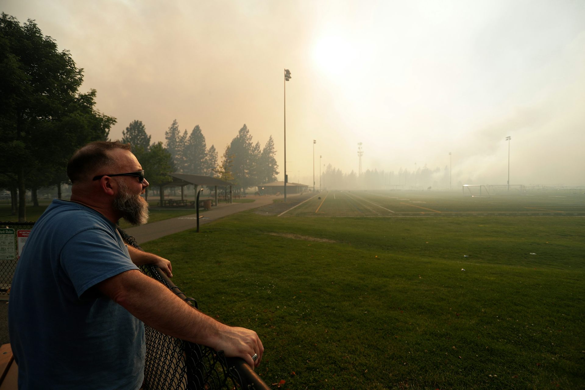
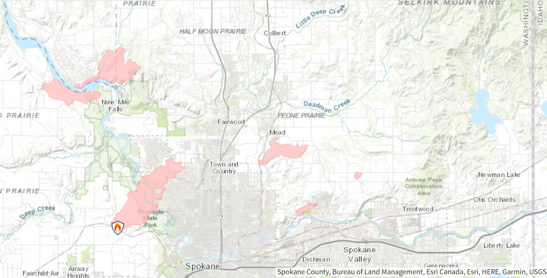

Three large wildfires raced through neighborhoods in and around Spokane, Washington, the weekend of Aug. 1, 2026, destroying at least 600 homes and other structures and threatening many more. Tens of thousands of people, including patients at the Veterans Affairs medical center, were forced to evacuate as crews from across Washington and Idaho battled fires that continue to burn.
Fortunately, residents and fire crews had some warning. One day before the fires broke out, the National Weather Service declared a rare “particularly dangerous situation” warning for the Spokane region, the first of its kind in Washington state.
Historically, fire officials have issued red flag warnings to indicate critical fire weather conditions, including low humidity and strong winds in conjunction with dry vegetation that could support the rapid spread of fires. A “particularly dangerous situation” alert elevates that warning, indicating a high risk of damage from an extremely rare and hazardous event.
Forecasters had reason to be worried. In Spokane, dry, windy conditions converged in what’s known as the wildland-urban interface – an area where neighborhoods have been built into the forests, shrublands and grasslands. That set the stage for the latest wildland-urban disaster in the U.S.
The Spokane fires, collectively known as the Spokane Complex Fire, resulted from a rare convergence of compounding factors.
Widespread drought conditions, driven in large part by a historic 2026 snow drought, played a large role.
Snowpack acts as a natural reservoir, storing winter precipitation and gradually releasing meltwater into early summer. With far below normal snowfall and exceptionally warm winter temperatures, forests dried weeks earlier than normal, leaving trees facing prolonged water stress and making them increasingly vulnerable to fires.
Despite generally dry conditions, spring rain, interspersed with periods of above-average temperatures, supported widespread growth of grasses, shrubs and other vegetation across the Northwest.
Exposed to scorching summer temperatures, this vegetation dried quickly and became highly flammable, leaving a continuous fuel bed where wildfires could ignite and rapidly spread.
When a dry cold front crossed the Inland Northwest on Aug. 1, it brought prolonged, sustained strong winds of 15 to 25 miles per hour, with gusts up to 45 mph, along with low humidity, which fueled the explosive growth of the Spokane fires.
More than 44,000 wildfires had burned more than 5 million acres across the U.S. in 2026 as of Aug. 3, well above the 10-year average for that point in the year. That included blazes raging in difficult terrain along the Utah–Colorado border that claimed the lives of three firefighters in June, and escalating fire activity that followed across the Northwest as summer progressed.
The extreme fire behavior of the Spokane Complex Fire was not unique among the Northwest’s many active fires in early August 2026. The Big Grass Fire, for example, along the Oregon–Idaho border, burned more than 300,000 acres.
In the Spokane area, however, the Old Trails, Fairview and Autumn Lane fires were all burning largely within wildland-urban interface landscapes, where forests, shrublands and grasslands are interspersed with residential and commercial buildings.
That environment created dangerous pathways for fire to spread into developed areas, ignite vulnerable structures and then propagate from one structure to the next. By Aug. 3, the Spokane fires had burned more than 8,000 acres, or about 12.5 square miles (32 square kilometers), and were still burning.
In our research as fire scientists and climatologists, we have found that more U.S. homes are being exposed to wildfire risk.
Our recent study indicates that 462,069 homes were exposed to large wildfires, meaning the homes were within wildfire boundaries, from 2001 to 2020 across the contiguous U.S.
Two-thirds of those homes were in the western U.S., where the number of homes exposed to large wildfires increased sixfold over that period. We found that home survivability – the fraction of homes that were within the boundaries of a large wildfire but not damaged – declined by 12% over the same period.
This trend is largely driven by three factors:
The increasing number of homes built in the wildland-urban interface – about 15 million were added from 1990 to 2020 across the U.S., a nearly 50% increase.
Worsening wildfire behavior due to intensifying droughts, warming temperatures and changing precipitation patterns.
A backbone of fuel accumulation in forests due to a legacy of largely successful fire suppression in fire-adapted Western landscapes that depended on periodic low severity burns to clear out dead fuel and litter.
Wildfires are a natural part of the North American landscape, particularly in the West. Historically, low-intensity fires periodically burned away low-lying vegetation before it could build up to fuel larger blazes.
Over the past century, however, with more people living in the wildland-urban interface, fires have been quickly suppressed, allowing vegetation to build up, which in conjunction with a warming climate enhanced the risk of larger fires.
There are, however, steps that communities and homeowners can take to reduce the risk of wildfires becoming disasters.
At the landscape scale, locally tailored prescribed burning and forest thinning to remove dry and overgrown vegetation can reduce the likelihood that fires will develop into fast-moving, high-severity events that threaten communities and ecosystems.
At the community scale, everyone from residents to local governments, community organizations and homeowner associations can collaboratively develop and implement community wildfire protection plans. These plans map vulnerable neighborhoods and critical infrastructure to find ways to reduce their risks in a fire. They also prioritize areas for fuel treatments, such as prescribed burns, and evacuation corridors to protect communities, strengthen emergency alert systems and improve access for firefighting.
At the individual-home scale, home hardening and creating defensible space around homes can reduce the probability of a fire reaching the home. Home hardening means fixing vulnerable components such as roofs, windows and openings through which wind-blown embers might enter. The area within 5 feet of a home, known as Zone 0, should be kept free of combustible materials. Beyond this zone, vegetation should be pruned, thinned and adequately spaced to avoid flames easily spreading.
These steps won’t ensure safety from wildfires, but they can help reduce the damage and risk to human lives.
This article is republished from The Conversation, a nonprofit, independent news organization bringing you facts and trustworthy analysis to help you make sense of our complex world. It was written by: Mojtaba Sadegh, Boise State University; United Nations University and John Abatzoglou, University of California, Merced
Read more:
Human exposure to wildfires has more than doubled in two decades – who is at risk might surprise you
Wildfire risk is soaring for low‑income, elderly and other vulnerable populations in California, Washington and Oregon
The West’s iconic forests are increasingly struggling to recover from wildfires – altering how fires burn could boost their chances
Mojtaba Sadegh receives funding from the US National Science Foundation, Joint Fire Science Program, US Forest Service, and NASA.
John Abatzoglou receives funding from the US National Science Foundation, the Joint Fire Science Program, and NOAA.







Comments