Two more tornadoes confirmed in Kansas City region this week. One tracked 36 miles
Published in News & Features
KANSAS CITY, Mo. — Two more tornadoes, including one that traveled more than 36 miles, touched down earlier this week as storms raced across the Kansas City region, the National Weather Service said in survey results released Wednesday.
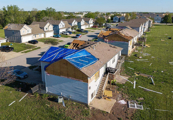
That brings the total number of confirmed tornadoes from the severe weather that moved through the region Sunday evening into Monday morning to six. So far this year, a total of 18 tornadoes have been confirmed in the National Weather Service’s Kansas City/Pleasant Hill forecast area.
That total does not include the tornadoes tracked by the National Weather Service’s Topeka forecast area, including an EF2 tornado that struck Ottawa on April 13.
The tornadoes also come as Kansas City’s 2026 severe weather season has started with a jolt, with a record number of severe thunderstorm and tornado warnings so far. The typical peak in severe storm activity is May, but severe weather can continue through the summer and into the fall.
Tornado near Tonganoxie
At about 3:31 a.m. Monday, a supercell thunderstorm moving across southern Leavenworth County, Kansas, spawned a brief EF1 tornado.
The tornado touched down west of U.S. 24 near Honey Creek Road southwest of Tonganoxie, damaging an outbuilding and trees west of the highway. The tornado lifted in an open field east of U.S. 24.
At its peak, the tornado had an estimated wind speeds of 105 mph with a width of 50 yards. It traveled less than a quarter-mile.
Tornado in Missouri
At about 6:52 a.m. on Monday, a tornado developed near Bluebird Trail about 5 miles southwest of Slater in Saline County, Missouri. It traveled about 36.51 miles before lifting about 4 miles southeast of Higbee in Howard County, according to a weather service report.
After touching down, the tornado, rated an EF2, produced intermittent tree damage as it moved northeast toward Missouri Route O, west of Slater. As the tornado passed through Slater, it strengthened, causing widespread tree damage with several homes and vehicles damaged from fallen trees and limbs.
Grain bins were heavily damaged north of Industrial Boulevard. Several nearby homes also suffered minor roof damage, according to the report.
The tornado continued to the northeast, causing damage in and east of Gilliam, where a large, uprooted tree fell onto a vehicle and a home. Dozens of power poles were downed or snapped along Missouri 240.
Hog barns and outbuildings near the damaged power poles were heavily damaged or destroyed, and a newly constructed barn north of the highway and east of Gilliam was severely damaged. Debris from the barn was carried more than 200 yards to the northeast.
The tornado continued to cause damage as it approached the Missouri River west of Glasgow. When it moved into the north side of the town, it produced significant tree, power line and shingle damage, according to the report.
The tornado then weakened as it moved northeast of Glasgow, primarily causing tree damage. It lifted near County Road A and County Road 136 in far northeast Howard County.
At its peak, the tornado had an estimated wind speed of 115 mph and a width of 350 yards. No injuries were reported.
©2026 The Kansas City Star. Visit at kansascity.com. Distributed by Tribune Content Agency, LLC.


Comments