Dual tropical storms hit both US coasts with floods and outages
Published in Weather News
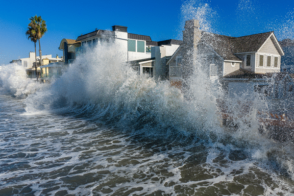
More than 440,000 homes and businesses from Pennsylvania to Florida are without power and flood threats are rising at both ends of the country as the U.S. deals with a rare double tropical threat from the remnants of storms Isaias off the Atlantic and Rachel moving into the Southwest from the Pacific.
In the East, there were 441,749 homes and businesses without power as the remnants of Isaias moved across Tennessee early Sunday, according to PowerOutage.com. The storm came ashore Friday night as a Category 2 hurricane and has killed at least four people, according to Facebook posts by officials in Alabama and Governor Ron DeSantis in Florida.
Meanwhile in the West, the remnants of Tropical Storm Rachel are racing across Southern California and raising flood risks from southern Idaho to Mexico’s Baja California, the U.S. National Hurricane Center said. Across Utah, more than 9,500 customers were without power, PowerOutage.com said.
A core of heavy rain from Rachel is bringing flood threats to the area west of Las Vegas and has raised warnings in Death Valley, said Dan Pydynowski, a meteorologist with commercial forecaster AccuWeather Inc.
For the U.S. to get squeezed by tropical systems on both coasts at the same time is “rare, but not unheard of,” Pydynowski said. “It certainly doesn’t happen every year and it is not common per se, but it does happen.”
In 2021, Hurricane Ida struck Louisiana, while moisture from Hurricane Nora off Mexico led to flooding rains across Arizona, Pydynowski said. A similar situation happened in 1992 when Hurricane Andrew slammed Florida and Hurricane Lester off the Pacific tracked through the U.S. Southwest.
To the south, Hurricane Simon, with winds of 150 miles per hour that make it a Category 4 storm on the five-step Saffir-Simpson scale, was raking the coast of Mexico’s states of Jalisco and Colima with some of its strongest winds, the U.S. hurricane center said. The storm may clip Jalisco later, when it makes an official landfall.
Pydynowski said the storm may also continue to move parallel to the coast and not make landfall until later in the week.
Heavy rain is forecast across Jalisco and waves up to nearly 20 feet (6 meters) may lash the coastline, according to Mexico’s weather service.
“Catastrophic wind and life-threatening storm surge impacts are likely along a portion of the west-central coast of Mexico,” Eric Blake, a senior hurricane specialist at the U.S. center, wrote in his outlook. “Heavy rainfall associated with Simon will impact portions of southwestern Mexico through this weekend.”
_____
©2026 Bloomberg L.P. Visit bloomberg.com. Distributed by Tribune Content Agency, LLC.






Comments