NHC again monitoring remnants of Tropical Storm Fay for possible redevelopment
Published in Weather News
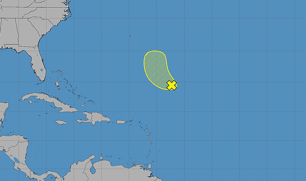
The National Hurricane Center is once again monitoring the remnants of Tropical Storm Fay as of Thursday and give the system a chance of redevelopment.
Fay, located several hundred miles southeast of Bermuda in the subtropical central Atlantic, reached tropical-storm status three times beginning Sept. 20. Most recently, it degenerated into a post-tropical cyclone on Tuesday.
“While thunderstorm activity has increased since yesterday, dry air and strong upper-level winds are expected to prevent significant re-development while it moves northwestward, to the east of Bermuda,” forecasters said. “Any formation chances should end by Sunday due to very strongupper-level winds.”
The NHC gives it a 10% chance of development within the next seven days.
The hurricane season has seen the formation of tropical storms Arthur, Bertha, Cristobal, Dolly, Edouard, Fay, Gonzalo and Hanna. Isaias is the next name on the list.
None has developed into a hurricane in the Atlantic this year, though, by Oct. 1 — a first since satellite tracking began in 1966.
Hurricane season began June 1 and runs through Nov. 30, but the height of hurricane season runs from mid-August through mid-October.
The National Oceanic and Atmospheric Administration last month updated its seasonal forecast and now expects between seven and 13 named storms this year. Of those, two to six would become hurricanes. It also predicted that there might not be any major hurricanes this year, or at most two.
Already, 2026 was forecast to have lower-than-average storm generation, and that has been reduced even further with the latest forecasts from the NOAA and other weather groups.
An average year would see 14 named storms and seven hurricanes, with three of those growing to Category 3 strength or higher.
________
©2026 Orlando Sentinel. Visit at orlandosentinel.com. Distributed by Tribune Content Agency, LLC.






Comments