Massachusetts nor'easter: The 'worst is yet to come' with gusty winds, heavy rains in Bay State
Published in Weather News
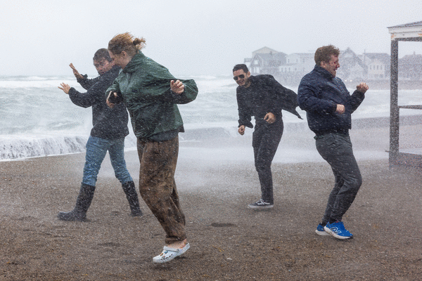
BOSTON — After heavy rain and gusty winds washed out Saturday, meteorologists say the worst of the nor’easter has yet to come in Massachusetts, cautioning Bay Staters to keep their guard up.
The Cape and Islands, South Coast and South Shore have all taken the brunt of the multiday storm so far, with thousands of households and businesses in the dark. But residents further inland can also expect to be hard hit before the nor’easter subsides for good, a pair of meteorologists told the Herald.
“The forecast has behaved fairly well,” National Weather Service Boston meteorologist Francis Tarasiewicz told the Herald Saturday evening. “We really haven’t been surprised by any sort of overperformance or underperformance.”
“We have seen the widespread 40- to 50-mph winds,” he added. “We did actually communicate that there may be a decrease in the winds throughout the day.”
Peak wind gusts soared over 60 mph across the Cape and the Islands, with Wellfleet seeing a 70 mph clip early Saturday afternoon, Tarasiewicz said. Nantucket also saw a 64 mph gust, he added.
These areas have also recorded widespread rain totals of over 3 inches. As vehicles became stranded and roadways closed in Fall River and New Bedford, a flash flood warning was triggered in the South Coast through Saturday evening.
Moving north and inland, Boston, Worcester and Fitchburg saw winds surge above 40 mph, but rain totals of between half an inch and an inch by 5 p.m.
The worst of the storm was expected Saturday night into Sunday morning, as northeast winds were forecast to be “relentlessly gusty,” at 35-45 mph for most inland locations and as high as 45-55 mph along the coast.
The NWS was also expecting the system to “dump a lot of rain over the next 72 hours thanks to the impressive moisture and dynamics,” with rainfall totals of 3 to 5 inches before the storm winds down late Monday into Tuesday.
“I want to caution people before they call it a bust and maybe let their guard down,” Tarasiewicz told the Herald. “You might go to bed with power and wake up without power. People may be downplaying it further inland; it hasn’t been as windy or rainy, but for many places inland, the worst is yet to come.”
Throughout Saturday, seawater flooded coastal parking lots and streets, as businesses tried to combat the surf with sandbags. Waves crashed forcefully over residential seawalls up and down the coast, from Swampscott to Hull.
As the steady, wind-lashed rain barreled up the coast on Friday, Ed Sheeran canceled his weekend concerts at Gillette Stadium in Foxboro, with the stadium and his team pulling the plug on the shows.
The nor’easter also caused MLB to send the Boston Red Sox and Chicago Cubs packing out of Fenway Park, after a day-night doubleheader on Friday. The two teams will wrap up the series, the final game of the regular season, on Sunday at Tropicana Field in Florida.
Nearly all outdoor events scheduled this weekend — from road races to farmers’ markets — were postponed ahead of Saturday.
AccuWeather Meteorologist Chad Merrill advised Greater Boston residents to prepare to be without power for at least a portion of Sunday and to watch for standing water. He agreed with Tarasiewicz that the worst has yet to come, especially when you combine the wind with the rain.
“Because the leaves are still on the trees,” Merrill told the Herald Saturday evening, “you don’t need prolific gusts to cause power line and tree damage. Plus, the heavy rain will loosen the soils and the roots in the soil, so that will allow the trees to sway a little more.
“Usually what happens when you have leaves on trees and a persistent wind, and lots of rain,” he added, “that can cause branches and trees to come down a little easier.”
©2026 MediaNews Group, Inc. Visit at bostonherald.com. Distributed by Tribune Content Agency, LLC.






Comments