Hurricane Marie tracking away from LA, but beaches will still be hit hard
Published in Weather News
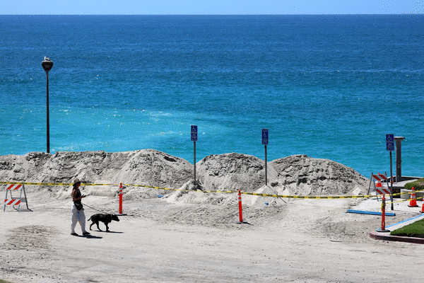
LOS ANGELES — Hurricane Marie is expected to stay off the California coast, reducing the potential for significant flooding and strong winds, but the storm is poised to deliver dangerous surf conditions and some tropical rain over Labor Day weekend.
All eyes have been on Marie’s trajectory since it formed in the eastern Pacific Ocean just offshore of Mexico early Tuesday. Meteorologists ran models for the system showing the most likely path and nearly all of them indicated that it would head west, away from land. But there were a few outliers suggesting the hurricane could head north into Southern California, raising concerns for the holiday weekend.
“The odds of an actual hurricane landfall from this particular weather setup was, and remains, essentially zero,” University of California climate scientist Daniel Swain wrote in a blog post.
But even from hundreds of miles away, Marie is still likely to leave its mark with a 6- to 8-foot south swell bringing strong surf and rip currents to the beach and a chance of rain and a return to muggy weather as thousands of people flock to the coast to celebrate the long weekend.
“Temperatures will not be overly warm, but it’s a holiday weekend and a warm time of year so we’re expecting a lot of people are planning beach trips and family events. We’d encourage people if you are planning a beach trip to swim where there’s a lifeguard and be aware of rip currents,” said Rose Schoenfeld, a meteorologist with the National Weather Service in Oxnard.
The storm is expected to bring back that muggy weather California experienced late last month with humidity levels ranging from 35% to 50% over the weekend and temperatures in the mid-80s along the coast.
There’s also a chance of light rain, measuring up to a quarter of an inch, arriving by Sunday across the region, Schoenfeld said.
“If you’re planning an outdoor event and your tolerance for rain is very low, we’d encourage people to look into alternate plans,” she said.
The south swell is also coinciding with a period of evening high tides, which could result in an “increasing chance of moderate coastal flooding” in low-lying areas including Avalon, the Alamitos Peninsula in Long Beach, Malibu and Point Mugu, according to the weather service.
It’s unlikely any significant rain from Marie will make it farther north than the Central Coast, the weather service office in Monterey said. But swells from the south could reach the Central Coast and Bay Area.
The weather service in San Francisco issued a beach hazards statement warning of 10-foot waves and strong rip currents beginning Friday morning through Monday evening.
“Stay off of jetties, piers, rocks, and other waterside infrastructure. Remain out of the water to avoid hazardous surf and NEVER turn your back on the ocean,” the weather service warns.
Similar warnings could be issued in the coming days in Southern California, forecasters said.
Elevated surf and rip currents as a result of Marie are arriving following a series of tragedies and increased rescues along Southern California beaches this summer.
Last week, a 41-year-old man who was bodysurfing in South Crescent Bay in Laguna Beach died after he was pulled out of the water.
On Aug. 3, a 24-year-old swimmer went missing after he was spotted struggling in the water in Laguna Beach. He was found by lifeguards and pronounced dead.
In June, a 5-year-old girl from San Bernardino was pulled into the ocean and drowned in Laguna Beach.
©2026 Los Angeles Times. Visit at latimes.com. Distributed by Tribune Content Agency, LLC.






Comments