Weather
/Knowledge
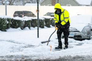
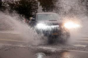
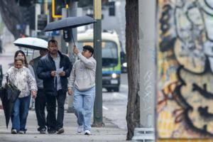
Bay Area chill to be lifted by another approaching atmospheric river storm
The chillier-than-usual temperatures that brought a cold-weather advisory early Monday won’t stay that way for much longer, according to the National Weather Service. The source for their eventual warmup: Yet another atmospheric river rain system.
“It’s gonna start to get a bit warmer Tuesday night into Wednesday morning,” NWS ...Read more
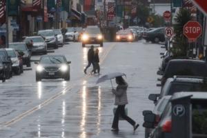
Southern California's wild weather is not over. Wind gusts of up to 65 mph predicted
Last week's rain won't be the end of Southern California's wild weather as strong wind gusts are forecast through the area until Tuesday.
Gusts of up to 65 mph are expected in mountains and valleys throughout the region, with the National Weather Service warning that power outages were possible and that residents should keep an eye out for ...Read more
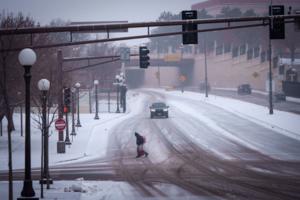
Winter storm to bring snow, possible blizzard conditions to Minnesota on Sunday
MINNEAPOLIS — A potent winter storm is expected to bring several inches of snow to much of the state, along with blizzard conditions in central and southern Minnesota beginning Sunday into Monday.
The National Weather Service has issued a winter storm warning for much of eastern Minnesota, while a blizzard warning is in effect for portions of...Read more
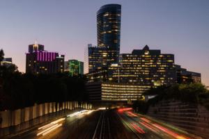
Atlanta sets record high amid unseasonable December heat
ATLANTA — Atlanta surpassed another record high temperature Saturday afternoon.
The average high for this time of year is around 54 degrees. But around 3 p.m., temperatures briefly climbed to 79 in the city, National Weather Service data reveals.
The previous record for the day was 75, set in 2015.
On Christmas Eve, Atlanta set a record ...Read more
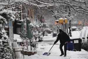
Post-Christmas storm blankets NYC with more than 4 inches of snow
NEW YORK — Christmas may officially be in the rearview, but there’s still plenty of winter ahead.
New Yorkers on Saturday woke up to the first major snowfall they’d seen in nearly four years. As of 7 a.m., the storm had passed, with the National Weather Service saying an approximate 4.3 inches of snow had fallen in Central Park.
It ...Read more
Post-Christmas storm blankets NYC with more than 4 inches of snow
NEW YORK — Christmas may officially be in the rearview, but there’s still plenty of winter ahead.
New Yorkers on Saturday woke up to the first major snowfall they’ve seen in nearly four years. As of 7 a.m., the storm had ended, with the National Weather Service saying an approximate 4.3 inches of snow had fallen in Central Park.
It ...Read more

California gets break from storms ahead of New Year's Eve rain
California is in for a brief weekend reprieve from damaging holiday storms that killed four people and hobbled Christmas travel, but weather officials warned of more wet weather heading to the rain-soaked state starting on New Year’s Eve.
Heavy rains pummeled much of California over the past seven days, bringing flash floods, mudslides, and ...Read more
Yes, that was a tornado in Los Angeles on Christmas
LOS ANGELES — A tornado did, in fact, spin through Los Angeles on Christmas, the National Weather Service confirmed, damaging a home and a commercial strip mall.
With a wind speed of up to 80 mph, the brief tornado traveled for about a third of a mile in Boyle Heights just after 10 a.m. Thursday. It was classified as an EF-0 on the Enhanced ...Read more
Post-Christmas storm blankets NYC with more than 4 inches of snow
NEW YORK — Christmas may officially be in the rearview, but there’s still plenty of winter ahead.
New Yorkers on Saturday woke up to the first major snowfall they’ve seen in nearly four years. As of 7 a.m., the storm had ended, with the National Weather Service saying an approximate 4.3 inches of snow had fallen in Central Park.
It ...Read more
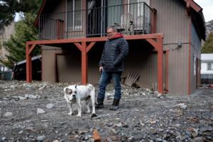
Winter storm buries Wrightwood, drenches Southern California: 'All it is is rock and mud,' resident says
LOS ANGELES — The Gamboa family isn’t quite sure how they’re going to get back into their home in Wrightwood.
When a powerful atmospheric river began drenching Southern California this week, they were forced to leave as the hills around them dissolved into a river of mud and debris, which by Friday was drying and hardening into a 3-foot ...Read more
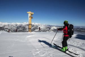
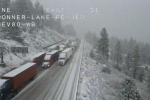
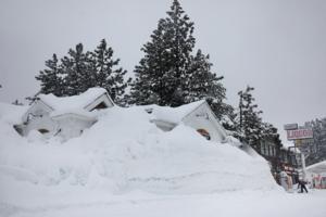
2 ski patrollers caught in avalanche at California's Mammoth Mountain after big storm
For the second time in less than a year, a pair of ski patrollers at Mammoth Mountain have been caught in an avalanche after a major snowstorm.
At about 7:30 a.m. Friday, before the resort in eastern California opened, the two were performing "avalanche mitigation work" when a sudden slide occurred on Lincoln Mountain, according to Joani Lynch,...Read more

Flights canceled, roads closed as storms hit US holiday travel
Major storms on both U.S. coasts and into the upper Midwest are disrupting travel plans during the busy postholiday period when many Americans are making their way back home.
More than 1,600 flights across the United States had been canceled as of 1:30 p.m. Eastern time Friday, according to the FlightAware website. There were more than 19,000 ...Read more
New Yorkers brace for biggest snow storm in years, up to 10 inches
NEW YORK — Christmas festivities are winding down while New Yorkers are gearing up for a major snow storm.
The fast-moving storm is poised to bring snow and ice to huge swaths of Northeast this weekend, with more than 23 million people under winter storm warnings, including New York City, which could see its most significant snowfall since ...Read more
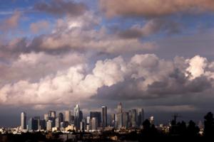
Southern California's wettest Christmas holiday ever, and the intensifying drought-to-deluge cycle behind it
LOS ANGELES — A year ago, officials were sounding alarms about a bone-dry winter that days later would combine with wind gusts of up to 100 mph to bring about the worst fires in Los Angeles history.
Now, Southern California just experienced its wettest Christmas in modern history.
This Christmas Eve and Christmas Day were the rainiest in ...Read more

SoCal's wettest Christmas holiday ever, and the intensifying drought-to-deluge cycle behind it
LOS ANGELES — A year ago, officials were sounding alarms about a bone-dry winter that days later would combine with hurricane-strength winds to bring about the worst fires in Los Angeles history.
Now, Southern California just experienced its wettest Christmas in modern history.
This Christmas Eve and Christmas Day were the rainiest in the ...Read more
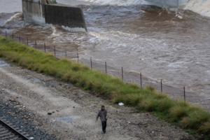
Southern California faces flood risk as storm begins to ease
Coastal communities in Southern California braced for more rain and flash floods even as a powerful Christmas storm began to ease on Thursday evening, with a state of emergency still in place for Los Angeles and neighboring counties.
The potential for flooding will be high through Friday, as more showers and thunderstorms pass through the area,...Read more
Thousands lose power, roads flood during Christmas storm in Sacramento area
A winter storm rocked the Sacramento region on Wednesday night and Thursday morning, bringing high winds, rain and power outages.
Here’s a roundup of what occurred and the weather outlook.
Outages around the Sacramento region
Numerous outages were reported around the greater Sacramento region during the storm.
One outage affected 3,947 PG&...Read more
Christmas Eve storm soaks Las Vegas Valley; flooding hits Death Valley
Christmas Eve has arrived and so has the rain for the Las Vegas Valley.
A fire hose of tropical moisture from the Pacific Ocean is bringing widespread showers to Southern Nevada. The valley is under a flood watch until 4 a.m. Christmas morning.
Large portions of the valley has seen considerable rain today, with one home in Centennial Hills ...Read more
LA wasn't dreaming of a wet Christmas, but that's what we got. And it can't be returned
LOS ANGELES — The most powerful Christmas storm in years slammed into Southern California on Wednesday, closing roads, flooding streets and drenching last-minute holiday shoppers.
The region’s wet Christmas is expected to continue through the weekend, though forecasters said Wednesday was expected to be the more intense day of rain. ...Read more
Thousands without power after punishing wind storm hits Bay Area; snow starts pummeling Sierra
SAN JOSE, Calif. — Thousands of people awoke without power Wednesday morning after a powerful storm slammed into the Bay Area, toppling trees and further complicating holiday travel across the region.
The North Bay, Peninsula and the South Bay appeared to bear the brunt of the latest storm front, which packed wind gusts topping out at 108 mph...Read more
Popular Stories
- Southern California's wild weather is not over. Wind gusts of up to 65 mph predicted
- Atlanta sets record high amid unseasonable December heat
- Post-Christmas storm blankets NYC with more than 4 inches of snow
- Winter storm to bring snow, possible blizzard conditions to Minnesota on Sunday
- California gets break from storms ahead of New Year's Eve rain
Comics