Bay Area chill to be lifted by another approaching atmospheric river storm
Published in Weather News
The chillier-than-usual temperatures that brought a cold-weather advisory early Monday won’t stay that way for much longer, according to the National Weather Service. The source for their eventual warmup: Yet another atmospheric river rain system.
“It’s gonna start to get a bit warmer Tuesday night into Wednesday morning,” NWS meteorologist Roger Gass said. “The temperatures are going to get warm with the arrival of the rain.”
That appearance by the rain is expected to be fueled by an atmospheric river system approaching from the southern Pacific Ocean. Gass said rain showers are expected to develop by Wednesday and that they will continue “off and on” all the way through the first weekend of the new year.
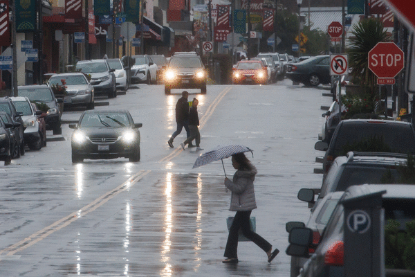
This system comes on the heels of an atmospheric-river storm that pounded the region on Christmas with rain, heavy winds, a bit of hail and reports of funnel clouds over the ocean.
“We do get them this time of year,” Gass said. “So it’s not out of the ordinary.”
The immediate effect will be to warm the area. Tuesday morning was still expected to be frigid, with a cold-weather advisory set to run from 1 a.m. to 9 a.m. for the second morning a row. Temperatures were again expected to fall into the mid- to low 30s in the East Bay interior valleys and hills, the eastern Santa Clara hills, the southern Salinas Valley, the North Bay interior valleys and areas of Monterey and San Benito counties.
Those temperatures all are expected to be significantly warmer Tuesday night into Wednesday morning, when the storm arrives, according to the weather service.
Similar to last week’s storm, the approaching atmospheric-river system is expected to drop heavy volumes of rain. The weather service anticipates 2½ to 3 inches of rain to soak the North Bay; most areas in that part of the region received at least 3½ inches in the last storm, and some received more than 5 inches.
San Francisco also can expect at least 2½ inches of rain in the next storm, while the South Bay and East Bay regions are forecast to get between 1 and 1½ inches, according to the weather service.
A coastal flood advisory along the Pacific Coast and the Bay Shorelines from Monterey to Cloverdale goes into effect Wednesday at 5 a.m. and will be in place until 2 p.m. Sunday. Weather service forecasters said more than 1¾ feet of flooding above the ground is possible in areas near shorelines and waterways.
That rain likely won’t bring the thunder and lightning and other severe storm elements that came with the Christmas week blast of weather. The winds — which gusted well over 100 mph in parts of the region last week — are not expected to be nearly as powerful.
“We don’t have thunderstorms in the forecast right now, but that’s likely to change as we get closer to the event,” Gass said. “Some of the winds are forecast to be stronger than others, but I wouldn’t anticipate them to be as strong as last week.”
In the Sierra Nevada, snow is expected to return above an elevation of 8,500 feet and perhaps 7,500 feet on Wednesday, but warmer temperatures may bring more rain than powder, according to the weather service. Overnight lows are expected to dip only to 27, and the daytime highs are expected to be at least in the 40s and perhaps as high as 51.
Snow is more likely for the that area on Friday and Saturday night.
_____
©2025 MediaNews Group, Inc. Visit at mercurynews.com. Distributed by Tribune Content Agency, LLC.


Comments