The ocean off California keeps breaking heat records
Published in News & Features


LOS ANGELES — An extreme marine heat wave is simmering the Pacific Ocean off the coast of California, and experts are warning that it could affect coastal weather and ecosystems for months.
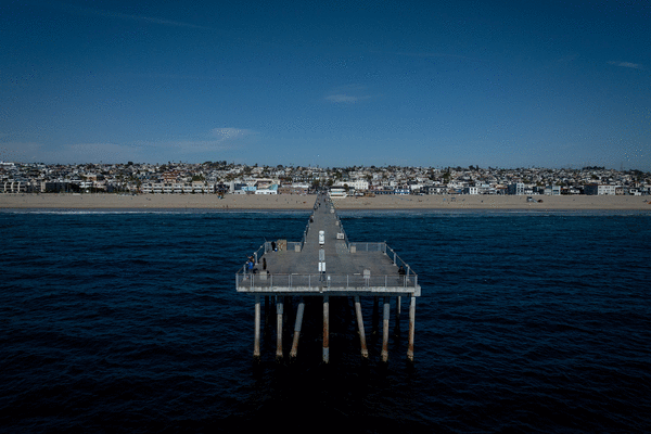
The ocean heat wave started forming at the end of last year but has worsened in recent weeks, according to readings from the Scripps Pier in La Jolla, which has broken more than 25 daily temperature records this year. The surface water temperature on Wednesday was 68.5 degrees — 7.7 degrees above average for the date. The sea bottom was 67.6 degrees, the hottest April 15 in about 100 years of records.
The heat wave is deep, persistent and widespread, spanning from roughly San Francisco to the Mexican border. Those are “pretty significant indicators that this has both staying power and will have consequences for weeks or months or even seasons to come for Southern California,” said Daniel Swain, a climate scientist with the University of California’s Agriculture and Natural Resources.
There are several factors driving the staggering heat, including a unyielding ridge of high pressure straddling Southern California and weaker-than-normal coastal winds, which typically drive upwelling along the coast. Upwelling is when cold, deep ocean water rises to the surface.
But human-caused climate change is undoubtedly pushing the temperatures to new records, Swain said, noting that it takes many times more energy to heat ocean water than it does to heat air. “From an ocean warmth perspective, we are now entering a pretty dramatic period” for this part of the world, he said.
El Niño could drive the ocean warmth even higher in the months ahead. The latest federal outlook includes a 61% chance that an El Niño will emerge between May and June and persist through at least the end of the year, with a 1-in-4 chance of a particularly strong El Niño. The tropical Pacific climate pattern is associated with warm, wet conditions in Southern California.
This year’s El Niño will feed off the marine heat wave, but once formed, El Niño will in turn help the marine heat wave intensify and persist, said Dillon Amaya, a research scientist at the National Oceanic and Atmospheric Administration’s Physical Sciences Lab. He said current models predict at least a 70% chance that the marine heat wave will continue off the coast of Baja through December.
“There are places in the world where it’s relatively easy to get big ocean anomalies like this, particularly the Gulf Stream or the Kuroshio Extension” near Japan, Amaya said. “But Baja is not one of those places. It is not easy to get an anomaly of this magnitude, so that in my mind makes it even more impressive — and terrifying.”
That’s because this event is reminiscent of “the blob” — a massive marine heat wave that took hold in the Pacific Ocean off the west coast of California from roughly 2014 to 2016. It brought major disruption to marine ecosystems: mass die-offs of seabirds, fishery disasters, kelp degradation, whale entanglements, sea lion starvation, fish migration and harmful algal blooms, Amaya said. That warm mass extended in patches along the West Coast and up through Canada and Alaska.
There are also potential effects on land, such as a reduced marine layer, because the warm water temperatures will make it harder for low clouds and fog to develop over land. That means less of the “May gray” and “June gloom” many Southern Californians have come to expect, Amaya said.
The conditions may also make coastal California feel more humid and muggy because of the loss of cooling fog and because warmer air holds more moisture, according to Swain. For Californians acclimated to dry heat, that could have potential health implications.
“Ninety degrees is not record-breaking heat, but 90 degrees with humidity is not something that folks in L.A. are necessarily prepared for,” he said. The same is true for warmer overnight temperatures, which are also likely to occur with this system and can make it harder for people’s bodies to cool down.
What’s more, the warm ocean waters could increase the chances of hurricanes and tropical storms forming off the coast of Mexico. Although such storms are typically hundreds of miles south of California, the state could still experience remnants of those systems, as it did with Hilary in 2023, Swain said.
There is less certainty around the effect on wildfire season in California. Although more storms and moisture could help quell blazes, there is also the chance that a dry lightning storm could spark them, he said.
Art Miller, a researcher at Scripps Institution of Oceanography, said the West Coast also saw a marine heat wave in 2019, which he referred to as “Blob 2.0.” That one was positioned off Northern California and into the Gulf of Alaska, and also led to considerable ecosystem disruption.
There is some concern that because these north Pacific marine heat waves are happening with similar — but not exactly the same — structures as the blobs, they may be part of a larger adjustment of the Pacific Ocean to climate change driven by greenhouse gases from fossil fuel burning, Miller said, although “the observational record is not long enough to conclusively say this.”
“But there is certainly clear evidence that the background average (sea surface temperature) is increasing in general in the oceans, obviously due to global warming, so that warm anomalies riding upon that long-term warming are occurring with ever-more-extreme magnitudes,” he said.
Amaya, of NOAA, said the current marine heat wave almost certainly would have formed in the absence of climate change. But the absolute temperature and the intensity of the system are “definitely a function of global warming.”
“As the world continues to warm, every marine heat wave will be warmer than the last one,” he said.
©2026 Los Angeles Times. Visit at latimes.com. Distributed by Tribune Content Agency, LLC.


Comments