Hurricane forecast points to a dangerous 2024 Atlantic season, with La Niña and a persistently warm ocean teaming up to power fierce storms
Published in News & Features
The 2024 Atlantic hurricane season starts on June 1, and forecasters are predicting an exceptionally active season.
If the National Hurricane Center’s early forecast, released May 23, is right, the North Atlantic could see 17 to 25 named storms, eight to 13 hurricanes, and four to seven major hurricanes by the end of November. That’s the highest number of named storms NOAA has ever forecast for a hurricane season.
Other forecasts for the season have been just as intense. Colorado State University’s early outlook, released in April, predicted an average of 23 named storms, 11 hurricanes and five major hurricanes. The European Centre for Medium-Range Weather Forecasts anticipates 21 named storms.
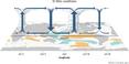
Colorado State also forecasts a whopping 210 accumulated cyclone energy units for 2024, and NOAA forecasts the second-highest ACE on record. Accumulated cyclone energy is a score for how active a given season is by combining intensity and duration of all storms occurring within a given season. Anything over 103 is considered above normal.
These outlooks place the 2024 season in league with 2020, when so many tropical cyclones formed in the Atlantic that they exhausted the usual list of storm names: A record 30 named storms, 13 hurricanes and six major hurricanes formed that year, combining for 245 accumulated cyclone energy units.
So, what makes for a highly active Atlantic hurricane season?
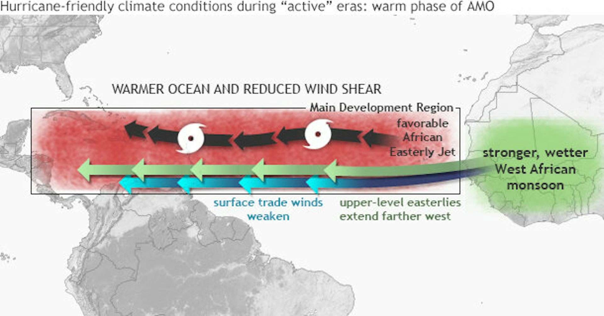
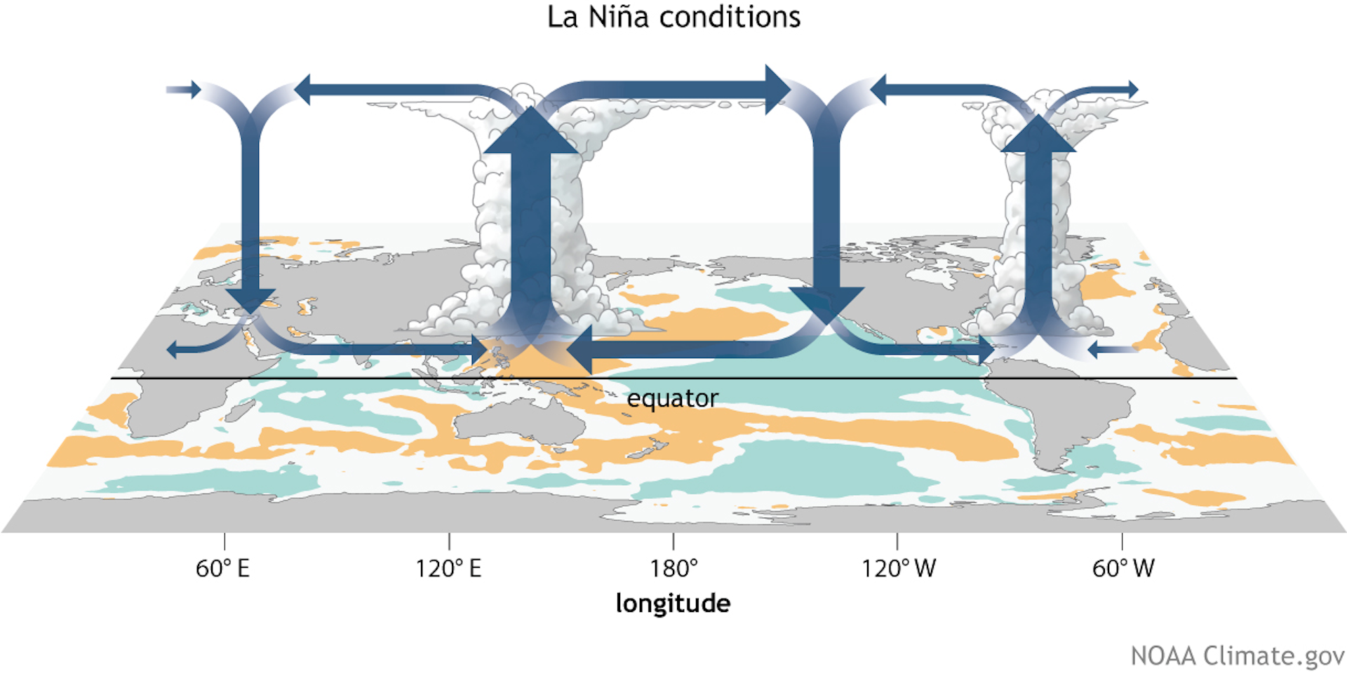
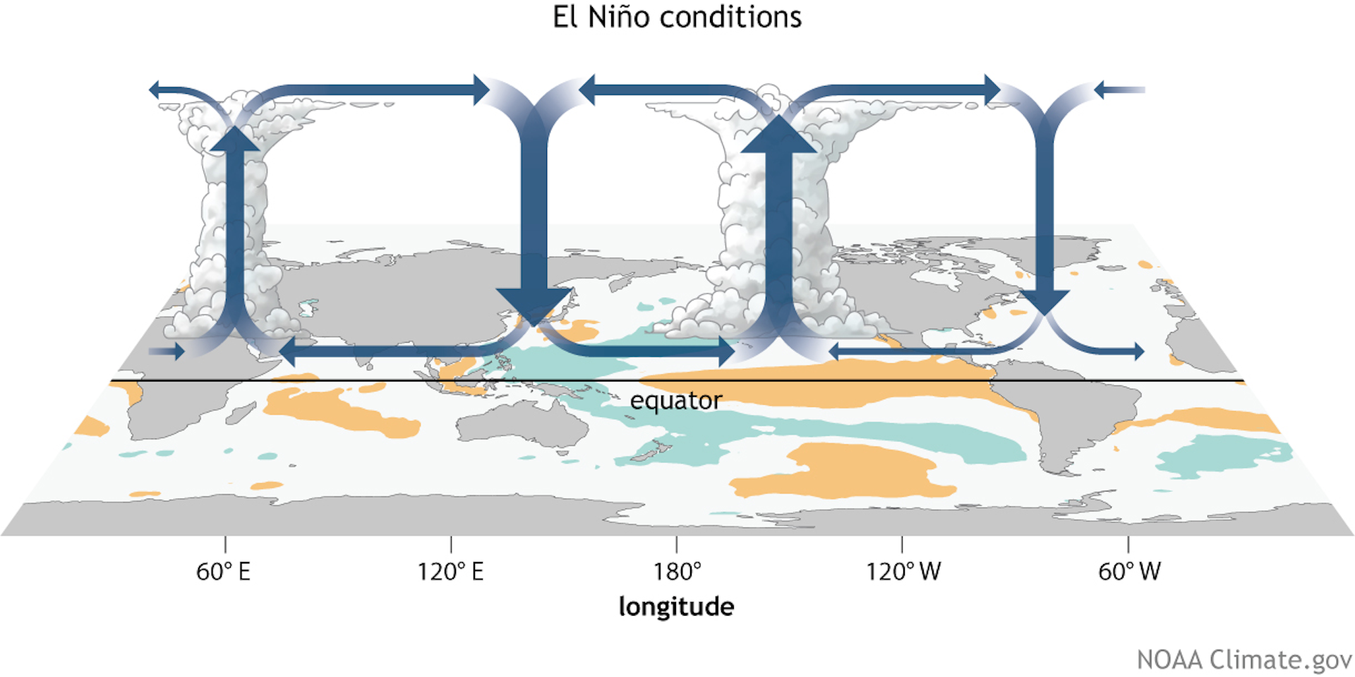
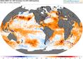
I am a climate scientist who has worked on seasonal hurricane outlooks and examined how climate change affects our ability to predict hurricanes. Forecasters and climatologists look for two main clues when assessing the risks from upcoming Atlantic hurricane seasons: a warm tropical Atlantic Ocean and a cool tropical eastern Pacific Ocean.
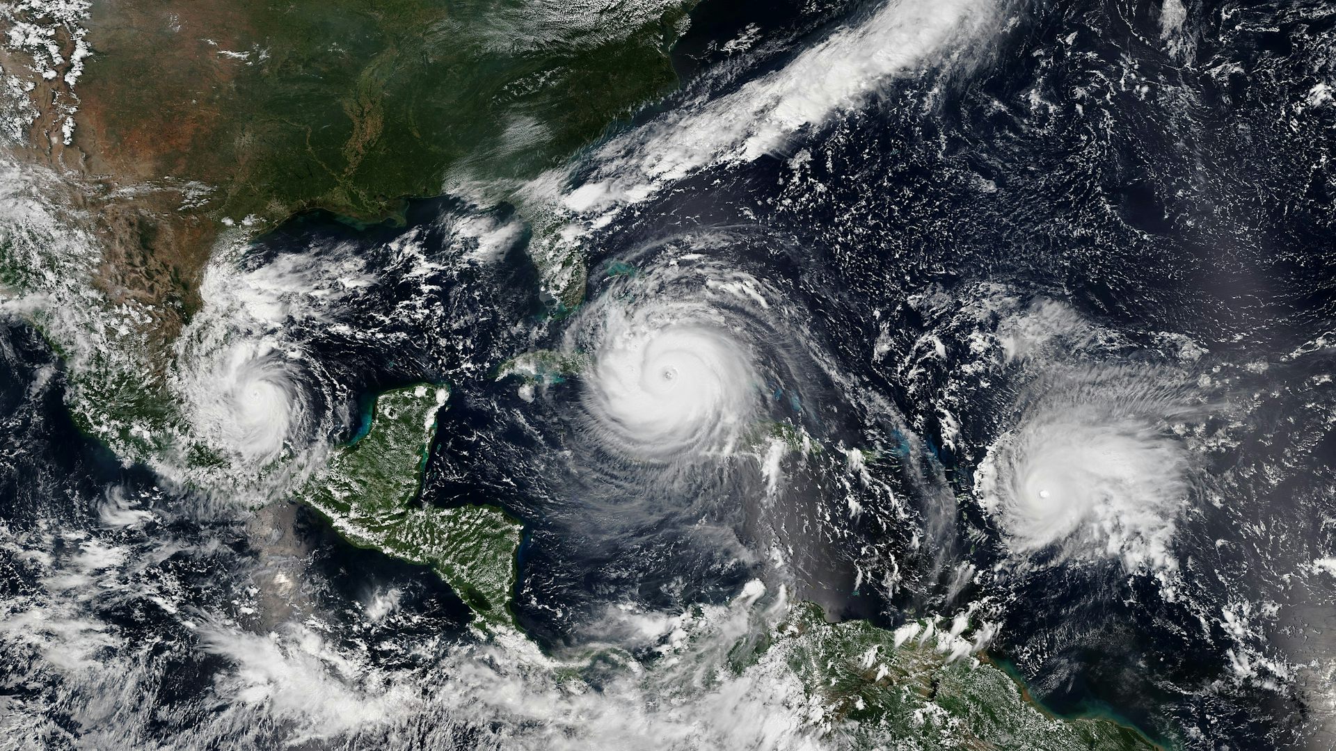
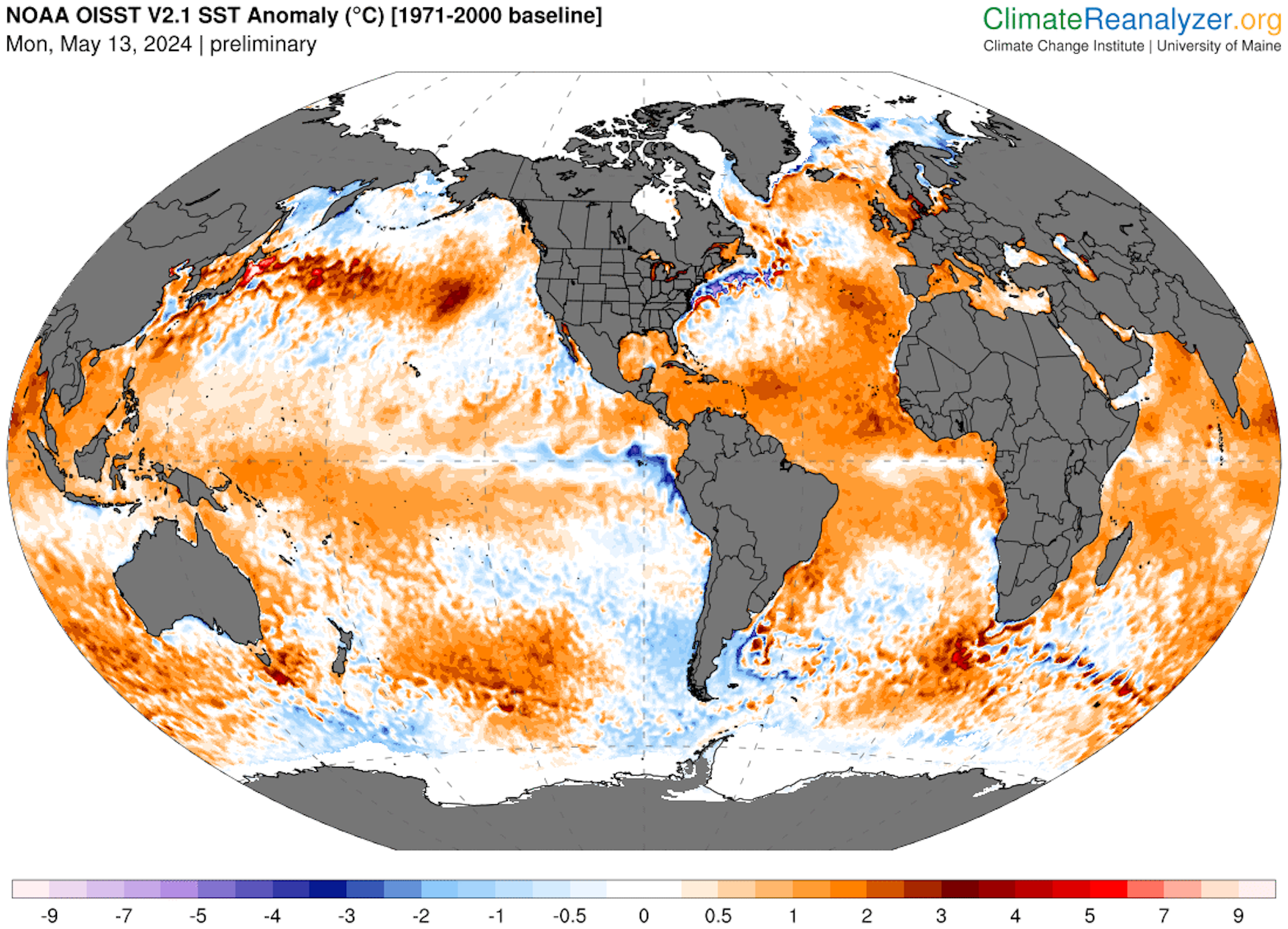
During the summer, the Atlantic Ocean warms up, resulting in generally favorable conditions for hurricanes to form.
Warm ocean surface water – about 79 degrees Fahrenheit (26 degrees Celsius) and above – provides increasing heat energy, or latent heat, that is released through evaporation. That latent heat triggers an upward motion, helping form clusters of storm clouds and the rotating circulation that can bring these storm together to form rainbands around a vortex.
Ocean heat in 2024 is a big reason why forecasters are warning of a busy hurricane season.
...continued


Comments