'We don't want to cry wolf:' How forecasters predict LA's next huge rain storm
Published in Weather News
LOS ANGELES — When it came to forecasting L.A.'s biggest winter storm of the season, local meteorologists had a secret weapon: experience.
For sure, there was plenty of computer modeling available to indicate that Southern California was in for a severe — and potentially dangerous — soaking. But based on their expertise, forecasters at the National Weather Service in Oxnard correctly anticipated that even the machine-calculated, eye-popping rain totals were probably an underprediction.
When it comes to such a serious storm event, getting the forecast as close to correct as possible isn't just a matter of pride. Forecasters go to great lengths to assess a storm's strength so they can accurately inform the public about the dangers it may pose.
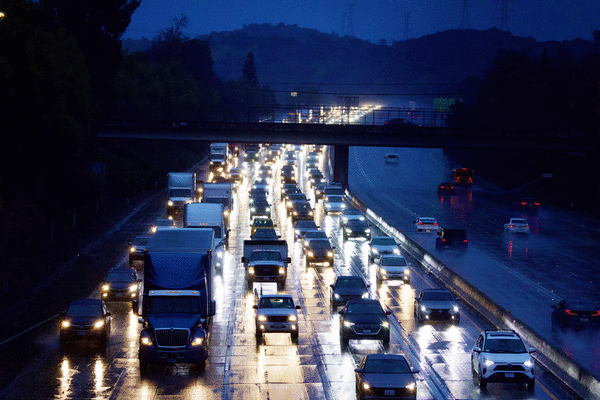
Forecasters will face another test in the coming days, when another storm is set for Presidents Day weekend. Showers are expected to move into western Los Angeles County on Saturday night before drying up Sunday morning. Then a second round of rain is forecast to begin Monday afternoon, ramping up during the evening and continuing through Tuesday night.
"We don't want to cry wolf and say, 'Oh, we're gonna get record amounts of rain, catastrophic flooding,' and then you get about half what you think. And people are like, 'That was no big deal,'" said Joe Sirard, a meteorologist at the National Weather Service office in Oxnard. "And then they'll tune us out. We don't want that to happen."
In this case, "We went a little bit above some of the models and, you know, we were right," Sirard said.
Sirard said the first indications of a potentially significant rain event emerged about 10 to 12 days ahead of the storm's actual arrival early this month.
To get an idea of a storm's possible strength, forecasters look at data generated by supercomputers that produce "ensemble forecasts" made from a series of model runs based on slightly tweaked initial conditions, Sirard said.
But the forecast is quite uncertain that far out.
Say you're trying to map out a forecast 10 days from now, when it looks like a storm is brewing. Half of the model runs might suggest 5 inches of rain will fall over a three-day period, but the other half could suggest less precipitation — sometimes significantly so.
Data like that might be too noisy to say anything with a great degree of confidence.
But as the storm draws closer, those models will start to align a bit more, giving forecasters a better idea of what to reasonably expect.
"And so that would increase our confidence levels," Sirard said. "Once you get in that seven-day window ... if these ensemble models are still showing, say, 60% hypothetically, 5 or more inches in a three-day period — already, our antennas are up. And it's like, 'OK, we got a potential for something significant coming in.'"
As forecasters get even closer to the storm's arrival, they can employ higher-resolution, shorter-range forecast models.
At a certain point, there was enough confidence for forecasters to post an attention-grabbing warning on social media on Feb. 1, three days before the storm's arrival: "We are expecting a major storm with dangerous, even life-threatening impacts!"
In subsequent days, local law enforcement and elected officials — from the city of Los Angeles to Santa Barbara County — held media briefings about the dire forecasts that included National Weather Service meteorologists.
Such coordination between meteorologists and politicians hasn't always happened. Unforgettably, although the National Weather Service office in Monterey issued a flood watch three days before a significant storm landed on Dec. 31, 2022, San Francisco officials were caught unprepared by a record deluge that flooded swaths of low-lying parts of the city and left residents and business owners furious.
There have also been memorable misses. Fourteen years ago, an unexpectedly powerful, slow-moving rainstorm unleashed a torrent of mud that inundated more than 40 homes in La Cañada Flintridge, a far cry from an initial forecast of a light to moderate rainstorm.
The models for the storm earlier this month did adjust in the days leading up to the event. Initial projections about three to five days ahead of the storm suggested Santa Barbara and Ventura counties would get hit the hardest. But as it drew closer, there were growing indications that Los Angeles County would bear the brunt, said Ryan Kittell, another meteorologist in the weather service's Oxnard office.
That ended up being the case.
The weather service also made late adjustments to what the computer models were showing. Over a four-day period, models said to expect 8 to 10 inches of rain in the San Gabriel Mountains and 4 to 5 inches of rain in downtown L.A.
Meteorologists thought the computer models were underpredicting the projected rainfall totals, so they added a couple of inches to that forecast, Sirard said.
Their instincts proved correct. The weather service's final forecast was for 8 to 14 inches of rain in the mountains and foothills through Feb. 6. And that was very accurate — the highest rainfall amount recorded in the San Gabriel Mountains over that period was 13.86 inches.
"A lot of us have been here for 25 years. So we know the weather patterns of what can cause the maximum amount of rainfall here," Sirard said. "You get the high amount of water vapor in the atmosphere, you get the strong jetstream aloft nearby, you have the strong southeast to south low-level flow — all that moisture throughout the atmosphere, from the ground to 20,000 feet or more — all gets squeezed up into the mountains."
In some areas, the storm proved to be a rainmaker more prolific than even experienced meteorologists had anticipated.
Before the storm began, the weather service had forecast 6.37 inches of rain would fall over a four-day period in downtown Los Angeles. Some people might've been hard-pressed to believe such an astonishing amount: On average, downtown gets 14.25 inches of rain in an entire year.
For the four-day period ending at 9 p.m. Feb. 6, 8.66 inches of rain fell on downtown L.A.
Still, the range of the forecast totals helped accurately guide the kinds of warnings that needed to be issued. Once forecast totals in lower-lying cities reach "5, 6, 7, 8 inches, the impacts are pretty much the same" in terms of flooding and landslide risk, Kittell said.
That messaging helped fuel substantial storm preparedness, so officials and residents were not caught completely off guard when land began sliding in a number of hillside communities across L.A. County, including north of Hollywood, Beverly Hills and Westwood, as well as in Baldwin Hills and Hacienda Heights.
Pre-storm warnings also let residents know to stock and stack sandbags. And officials readied response teams like swift-water rescue crews that were needed across Southern California.
©2024 Los Angeles Times. Visit latimes.com. Distributed by Tribune Content Agency, LLC.


Comments