Hurricane Ian capped 2 weeks of extreme storms around the globe: Here's what's known about how climate change fuels hurricanes
Published in Science & Technology News


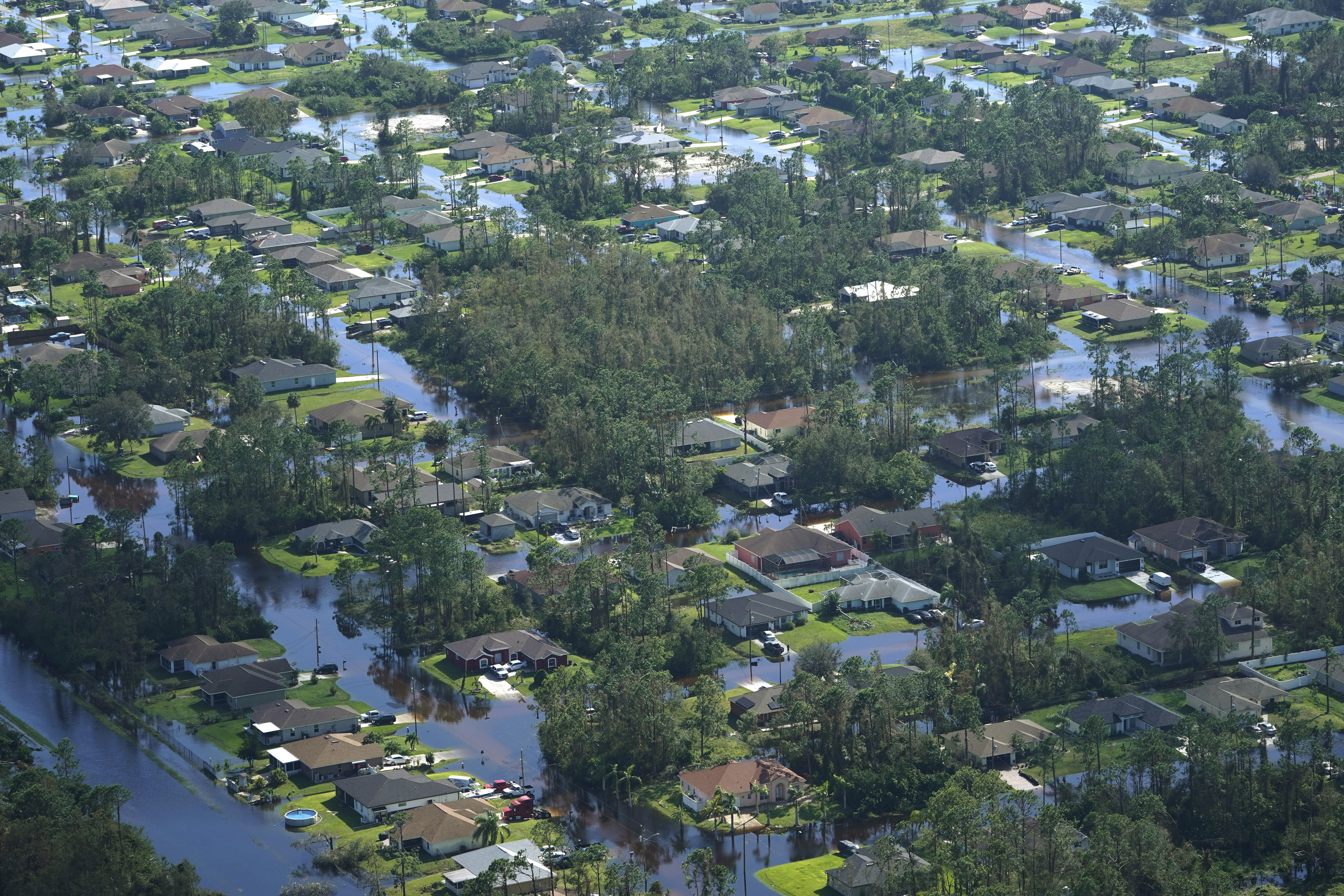


When Hurricane Ian hit Florida, it was one of the United States’ most powerful hurricanes on record, and it followed a two-week string of massive, devastating storms around the world.
A few days earlier in the Philippines, Typhoon Noru gave new meaning to rapid intensification when it blew up from a tropical storm with 50 mph winds to a Category 5 monster with 155 mph winds the next day. Hurricane Fiona flooded Puerto Rico, then became Canada’s most intense storm on record. Typhoon Merbok gained strength over a warm Pacific Ocean and tore up over 1,000 miles of the Alaska coast.
Major storms hit from the Philippines in the western Pacific to the Canary Islands in the eastern Atlantic, to Japan and Florida in the middle latitudes and western Alaska and the Canadian Maritimes in the high latitudes.
A lot of people are asking about the role rising global temperatures play in storms like these. It’s not always a simple answer.
It is clear that climate change increases the upper limit on hurricane strength and rain rate and that it also raises the average sea level and therefore storm surge. The influence on the total number of hurricanes is currently uncertain, as are other aspects. But, as hurricanes occur, we expect more of them to be major storms. Hurricane Ian and other recent storms, including the 2020 Atlantic season, provide a picture of what that can look like.
Our research has focused on hurricanes, climate change and the water cycle for years. Here’s what scientists know so far.
The temperature of both the ocean and atmosphere are critical to hurricane development.
Hurricanes are powered by the release of heat when water that evaporates from the ocean’s surface condenses into the storm’s rain.
A warmer ocean produces more evaporation, which means more water is available to the atmosphere. A warmer atmosphere can hold more water, which allows more rain. More rain means more heat is released, and more heat released means stronger winds.
These are basic physical properties of the climate system, and this simplicity lends a great deal of confidence to scientists’ expectations for storm conditions as the planet warms. The potential for greater evaporation and higher rain rates is true in general for all types of storms, on land or sea.
...continued


Comments